Korea’s most rewarding “hidden gems” are not necessarily secret. They are places that international visitors often miss because reaching them requires a regional bus, a ferry, or more planning than a standard Seoul-to-Busan itinerary. The seven destinations below offer distinctive landscapes, local history, and room for slower exploration.
Transport schedules, ferry departures, admission charges, and operating hours were checked where official information was available on June 11, 2026. Regional information is frequently published only in Korean and may change seasonally, so confirm the final details shortly before traveling.
At a glance
| Place | Region | Main reason to visit | Suggested time | Car helpful? |
|---|---|---|---|---|
| Suseongdong Valley | Seoul | Historic valley below Inwangsan | 2–4 hours | No |
| Garimseong Fortress | Buyeo | Baekje history and hilltop views | Half day | Yes |
| Seonyudo and the Gogunsan Islands | Gunsan | Coastal cycling and connected islands | Full day or overnight | Helpful |
| Upo Wetland | Changnyeong | Wetland walks and birdwatching | Half or full day | Yes |
| Hwanseon Cave | Samcheok | Vast limestone cave and mountain scenery | Half day | Helpful |
| Cheongsando | Wando | Island villages and long-distance walking | At least one night | Helpful |
| Gyodongdo | Ganghwa | Rural border-island landscapes | Full day | Yes |
1. Suseongdong Valley: a quiet side of central Seoul
Suseongdong Valley (수성동계곡) sits below Inwangsan Mountain, west of Gyeongbokgung Palace. Although it is close to some of Seoul’s busiest historic districts, the upper valley feels markedly removed from the traffic below.
The valley appears in the work of Joseon-period landscape painter Jeong Seon. After apartment buildings encroached on the site in the 20th century, Seoul restored the valley landscape and reopened it as a public space. The result is not a wilderness hike but a compact combination of streambed, stone bridge, woodland, and mountain views.
How to visit
Take Seoul Subway Line 3 to Gyeongbokgung Station and continue by local bus, taxi, or on foot through Seochon. Searching for 수성동계곡 in Naver Map or KakaoMap generally produces more useful walking directions than an English search.
Entry to the outdoor valley was free when checked on June 11, 2026. It does not have conventional attraction hours, but daylight is preferable because some paths are uneven and lighting is limited.
Combine the valley with Seochon’s lanes or a section of the Inwangsan trail. The climb becomes steep above the valley, so ordinary walking shoes are sufficient only if you remain in the lower park.
Practical details are available through the Seoul Metropolitan Government’s English website and the Jongno District English website.
2. Garimseong Fortress: Baekje history without the tour groups
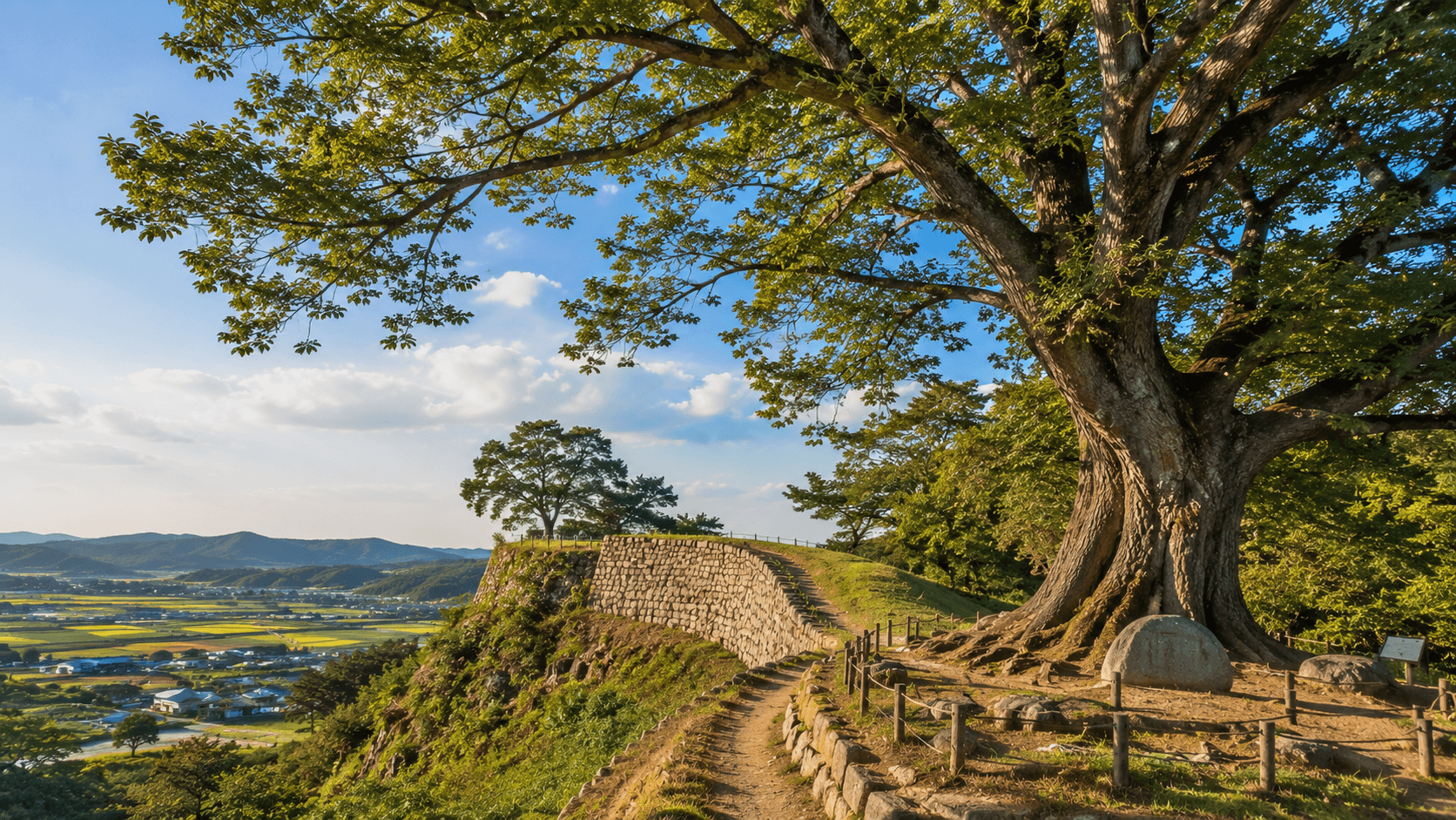
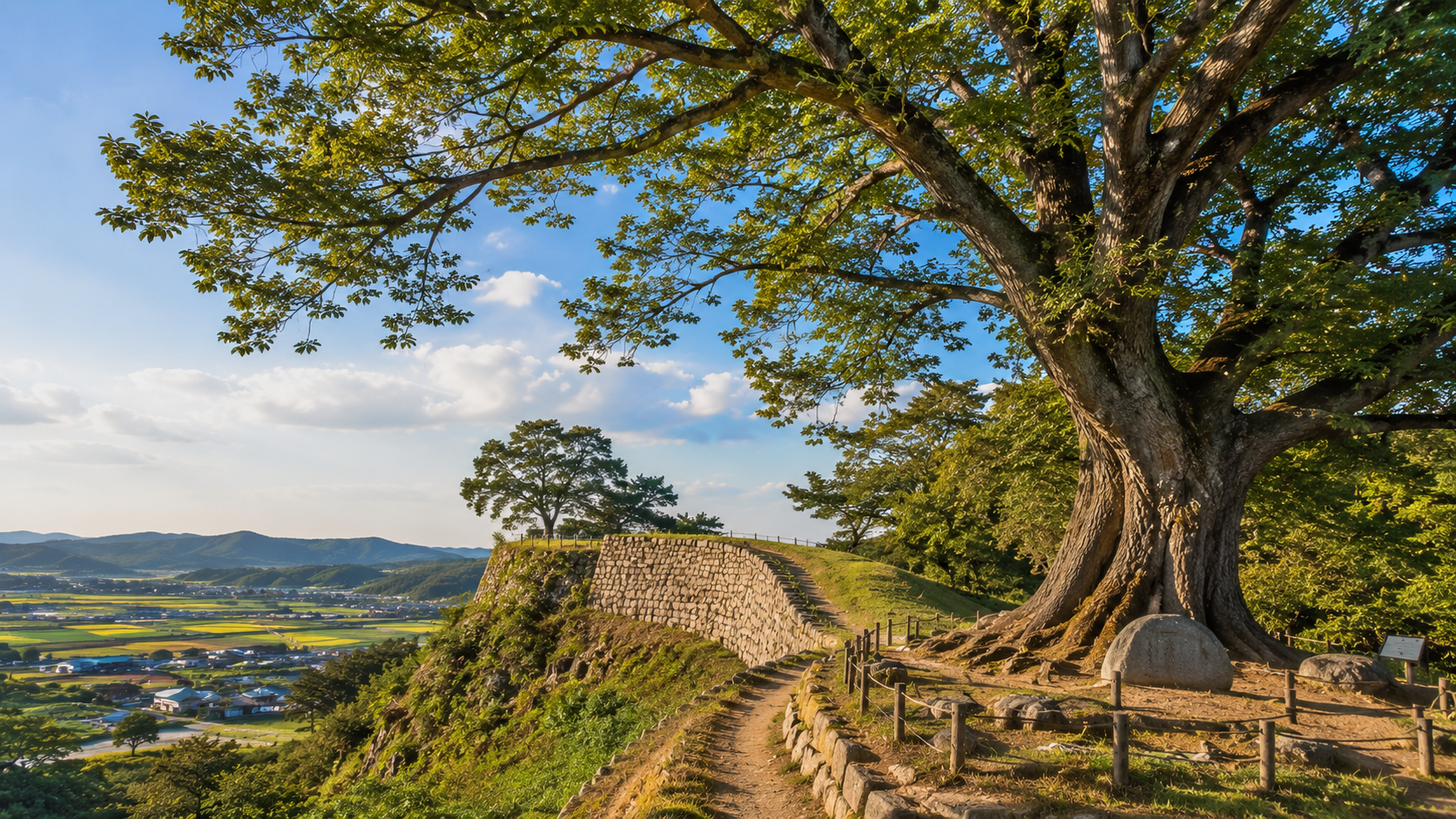
Garimseong Fortress (가림성), also commonly called Seongheungsanseong Fortress (성흥산성), stands on Seongheungsan Mountain in Buyeo County. It was built during the Baekje kingdom and is designated Historic Site No. 4.
Only portions of the original mountain fortress remain, but the hilltop setting helps explain its defensive purpose. Visitors come for the surviving stonework, open views over the countryside, and a large zelkova tree near the summit. The tree is often called the “love tree” in Korean travel content because of its silhouette, but the historical site is more significant than the photo spot.
How to visit
The fortress is outside central Buyeo, and local bus service can be infrequent. A taxi or rental car is the practical option for most international visitors. Save the Korean name and return destination before leaving town, particularly if you plan to call a taxi through an app.
There was no general admission fee for the outdoor fortress site when checked on June 11, 2026. No dependable official English operating schedule was published, so visit during daylight and check for temporary access restrictions during heavy rain, snow, maintenance, or wildfire-risk periods.
Wear shoes with grip. The final approach includes a slope and irregular ground, and the site is not fully accessible for wheelchairs or travelers who cannot manage steps.
Use the Korea Heritage Service’s English heritage search for the official historical designation. Buyeo travel planning information is available from the Buyeo County tourism website.
3. Seonyudo and the Gogunsan Islands: bridges, beaches, and bicycles
Seonyudo (선유도) is part of the Gogunsan Islands off Gunsan’s west coast. Road bridges now connect several of the main islands, allowing visitors to move between fishing villages, beaches, rocky viewpoints, and small harbors without taking a ferry between every stop.
This is a good alternative to a tightly scheduled resort island. The appeal lies in moving slowly through Seonyudo, Munyeodo, Jangjado, and nearby islands rather than checking off a single landmark. Cycling is popular, although hills, wind, summer traffic, and narrow roads can make the route harder than it looks on a map.
How to visit
From Gunsan, regional buses run toward the Gogunsan area, but frequency and stopping patterns can vary. Driving provides more flexibility, especially outside summer. Do not assume that the last return bus will be late in the evening.
The islands themselves have no general admission charge. Individual activities, parking areas, bicycle rentals, seasonal facilities, and private attractions may charge separate fees. Prices and local bus times could not be confirmed consistently through a current official English source on June 11, 2026, so check the Gunsan city tourism website and a Korean navigation app before departure.
Bring water and sun protection outside winter. Restaurants and convenience stores exist around the main visitor areas, but choices decrease away from Seonyudo’s central streets. Reserve accommodation ahead for summer weekends and public holidays.
4. Upo Wetland: Korea at reed-bed level
Upo Wetland (우포늪) in Changnyeong is a protected inland wetland with reed beds, open water, agricultural margins, and low walking routes. Its value is ecological rather than spectacular: the landscape rewards patient observation, especially early in the day.
The wider wetland complex includes Upo, Mokpo, Sajipo, and Jjokjibeol. Wildlife varies by season, and no particular bird sighting can be guaranteed. Winter is associated with migratory birds, while warmer months bring dense vegetation, insects, and strong sun.
Planning your route
Start near the Upo Wetland Ecological Center if you want orientation before walking. Paths around the wetland cover more ground than first-time visitors often expect, so decide whether you want a short observation walk or a longer circuit.
Public transportation to the wetland is possible through Changnyeong, but the final connection can be slow and infrequent. A car or taxi is easier. Arrange a return taxi in advance if you are visiting on a quiet weekday.
Access rules, bicycle availability, ecological-center hours, and temporary trail closures can change. The official English pages did not provide a complete, clearly current set of hours and charges when reviewed on June 11, 2026. Confirm them through the official Upo Wetland website or the Changnyeong County government.
Stay on designated paths, keep noise low, and do not feed wildlife. Shade can be limited, while mosquitoes and other insects are common in warm weather.
5. Hwanseon Cave: an enormous underground landscape
Hwanseon Cave (환선굴) lies in the mountain interior of Samcheok, Gangwon State. The visitor route uses elevated walkways through large limestone chambers containing streams, pools, and waterfalls. Its scale makes it feel very different from smaller caves designed around decorative formations.
Reaching the entrance is part of the trip. Visitors can walk uphill or, when operating, use the separate monorail. Even with the monorail, expect stairs, damp surfaces, and considerable walking inside the cave.
What to know
Samcheok’s cave district is easiest to reach by car. Bus travel is possible but requires careful coordination with limited regional services. Leave enough time to return before the final bus rather than relying on a navigation app’s ideal connection.
Admission fees, last entry, and monorail charges are time-sensitive. A stable 2026 English price table could not be confirmed on the official site on June 11, 2026, so check the Samcheok city tourism website immediately before visiting. The cave may close temporarily because of weather or facility inspections.
Wear a light outer layer even in summer, along with shoes suitable for wet metal walkways. Travelers with limited mobility should contact the operator before making the journey; the cave route is not step-free.
6. Cheongsando: an island that requires time
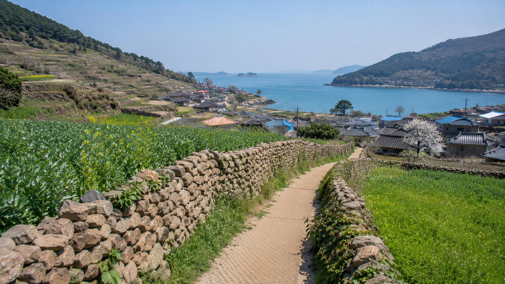
Cheongsando (청산도), reached by ferry from Wando, is known for terraced fields, stone walls, fishing settlements, and the Cheongsando Slow Walking routes. Eleven main courses form a wider trail network, but most visitors should choose a few connected sections rather than attempt the entire system.
The island works best as an overnight destination. A day trip leaves little margin for ferry disruption and can turn a slow-travel destination into a race back to the port.
Ferry and accommodation planning
Passenger ferries normally depart from Wando, but times vary by date and season. Sailings can be delayed or canceled because of wind, waves, fog, or operational changes. The complete schedule and fare for a future travel date were not reliably available in English when checked on June 11, 2026.
Consult Wando County’s official tourism website and confirm the sailing with the terminal or operator before traveling. Arrive early with your passport or accepted identification. Vehicle spaces may require advance booking and can sell out before passenger seats.
Accommodation is concentrated around the port and villages. Reserve ahead during spring, weekends, and Korean public holidays. Bring cash as a backup, although many established businesses accept Korean cards. Foreign cards may not work in every small restaurant or ticketing system.
7. Gyodongdo: a rural island near the border
Gyodongdo (교동도) belongs to Ganghwa County in Incheon but feels far removed from metropolitan Seoul. The island contains rice fields, low villages, coastal landscapes, and Daeryong Market, whose narrow lanes preserve the scale of a mid-20th-century local market district.
Its location near the inter-Korean border means visitors may encounter military facilities, checkpoints, fences, and photography restrictions. Follow posted instructions and never photograph military personnel or installations.
Getting there responsibly
Gyodongdo is connected by bridge, but a car is the most practical way to explore it. Bus travel from Seoul requires transfers and leaves less flexibility. Carry your passport or Korean residence card because identification checks may occur near controlled areas.
There is no general island admission fee. Individual museums, experiences, parking areas, or attractions may have their own charges and schedules. Conditions were reviewed on June 11, 2026, but border-area access can change without normal tourist notice. Check the Ganghwa County English website before departure and obey local signs after arrival.
Daeryong Market is a functioning local district, not an open-air film set. Keep doorways clear, ask before photographing identifiable residents, and avoid entering private courtyards.
Practical planning tips
Use Korean map apps
Naver Map and KakaoMap generally provide better regional bus stops, walking entrances, and Korean place names than international map services. Save each destination in Hangul before leaving reliable Wi-Fi.
Allow for long final connections
A destination that appears two hours from Seoul by car may take considerably longer by public transport. Regional buses can be separated by long intervals, and the final service may finish earlier than expected.
Carry more than one payment method
Bring a transport card for buses, a physical credit or debit card, and some KRW cash. Overseas cards can fail in small ticket offices, unmanned machines, or rural businesses. Mobile payment systems commonly require a Korean account or identity verification.
Do not build tight plans around ferries
Stay overnight before or after an island trip when missing one departure would affect a flight or long-distance train. Weather cancellations are operational decisions, and having a reservation does not guarantee that a vessel will sail.
What to check before you go
- Confirm opening days, last admission, and seasonal closures on an official website.
- Recheck ferry or regional bus times on the day before departure.
- Download Korean place names and offline screenshots of the final route.
- Check the Korea Meteorological Administration forecast, including wind and heavy-rain alerts.
- Carry identification for ferries and visits near controlled border areas.
- Confirm whether your accommodation accepts late check-in and foreign cards.
- Ask about stairs and accessible routes if anyone in your group has limited mobility.
- Avoid mountain, cave, wetland, and coastal trails during official weather warnings.
Sources
- Korea Tourism Organization: VISITKOREA
- Seoul Metropolitan Government
- Korea Heritage Service
- Gunsan City tourism information
- Upo Wetland official website
- Samcheok City tourism information
- Wando County tourism information
- Ganghwa County English website
Choose one destination that fits your route, then build the day around its final bus or ferry rather than trying to add it as a rushed side trip.